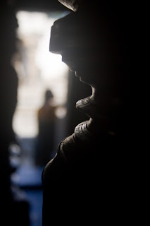
Bylakuppe - Buddhist Golden Temple

Bylakuppe is the location of "Lugsum Samdupling" (established in 1961) and "Dickyi Larsoe" (established in 1969), two adjacent Tibetan refugee settlements, as well as a number of Tibetan Buddhist monasteries. The area is located in the west of the Mysore district in the Indian state of Karnataka
 Monks praying

The main attraction of the town is the Namrodoling Monastery (Golden Temple).There are many Buddhist monasteries and schools which give quality education for buddhist monks.


The settlements were established on land leased by the state government to accommodate some of the Tibetan refugees who came to resettle in India after 1959. Bylakuppe consists of a number of agricultural settlements / small camps close to each other, and has a number of monasteries, nunneries and temples in all the major Tibetan Buddhist traditions. Most notable among them are the large educational monastic institution Sera, the smaller Tashilunpo monastery (both in the Gelukpa tradition) and Namdroling monastery (in the Nyingma tradition).

Dubare Elephant Camp

Dubare is known for its elephant camp, and is a forest camp on the banks of the river Kaveri in the district of Kodagu, Karnataka. It is an important base for the Karnataka Forest Department's elephants.

There are opportunities for trekking, elephant rides, fishing, and river rafting. these activities are hosted by Jungle Lodges and resorts


The moist deciduous forests of Dubare are home to many wild animals and birds. Sighting of wild Asiatic elephants are regular and so is spotting the sambhar and the spotted deer. tiger, leopard, wild dogs, gaur and bears are also seen in these forests. Crocodiles can be seen in river. The forests are also home to many reptiles non-venomous snakes.

Bhagamandala Temple

Bhagamandala is a pilgrimage place in Kodagu, Karnataka, in India. It is situated on the river Kaveri in its upstream stretches. At this place, the Kaveri is joined by two tributaries, the Kannike and the mythical Sujyoti river. It is considered sacred as a river confluence or triveni sangama.

A short distance from the triveni sangama, there is a famous temple known as Sri Bhagandeshwara temple, where Bhagandeshwara (Ishwara), Subramanya, Mahavishnu and Ganapati idols are installed. This place is also known as Bhagandeshwara Kshetra, from which the name Bhagamandala is derived. The temples in this area are built in Kerala style which is also similar to the temples in Nepal.

During 1785–1790, the area was occupied by Tipu Sultan. He renamed Bhagamandala to Afesalabad. In 1790 King Dodda Vira Rajendra took Bhagamandala back into an independent Kodagu kingdom.

It is a common practice for pilgrims to take a dip in the triveni sangama and perform rituals to their ancestors before proceeding to Talakaveri, the birthplace of Kaveri

Coorg Trip - Abby Falls

Abbey Falls (also spelled Abbi Falls and Abbe Falls), in the Western Ghats in Karnataka, India. It is located 8 km from the town of Madikeri also known as the head quaters of Coorg
 The waterfall is located between private coffee plantations with stocky coffee bushes and spice estates with trees entwined with pepper vines. The falls appear suddenly, the water cascading over rocks into calm pools. A hanging bridge constructed just opposite the falls comes in handy for the Tourists. There is a Kali Mata temple on the other side of the bridge and Coffee and Black Pepper trees on the other side.


Coorg Trip - Nature

Kodagu also known by its anglicised former name of Coorg, is an administrative district in Karnataka, India. It occupies an area in the Western Ghats of southwestern Karnataka.

The Kodavas were the earliest agriculturists in Kodagu & have large parts covered with coffee plantations. During this time, South Indian dynasties such as the Kadambas, the Gangas, the Cholas, the Chalukyas, the Rastrakutas, the Hoysalas and the Vijaynagar Rayas ruled over Kodagu.


Kodavas being known in India as "brave warriors" and members of the Indian warrior caste, Kodagu did not have indigenous rulers as the Kodavas failed to evolve political consensus.


Yercaud Trip

Yercaud got its name from the Tamil words, yeri and kaadu, meaning lake and forest respectively. The British discovered it in the early 19th century. There are accounts of coffee plantations being introduced by a British officer in the area in the second decade of the 19th century.

Sun rise in Yercaud


Yercaud Town is situated above 4800' from mean sea level. 
On the way to Yeraud, there are 20 hairpins and it is a tough ride up the hill. We can see beautiful scenery of the mountains coming out of the clouds....

Shevaroy Temple
The highest point in Yercaud Taluk is Shevaroy Temple which is situated at a height of 5326'. Hence, Yercaud hill area is called  "Shevaroyan Hills". It is also called "Ooty of the Poor". This is the third highest range in this part with a modern cave temple at its top. The hill top is bald with a real open view of all the hills around.

I was not able to get a good picture of the temple but the picture below is the back side of the temple
Killiyur Falls
The water is from the Big Lake that connects to the falls through a stream. A long walk through the enchanting woods takes you to Killiyur Falls.

Kiluyur water falls had a small water fall when we went but during the months of Nov - Dec we can see excess waters of the Yercaud lake and the other reaches of the Shevaroyan Hills and falls deep into the Kiliyur Valley at 300 feet.


Lady Seat
One of the best views that Yercaud promises.You get a panoramic view of the ghats and all the distant vehicles dwindling their way in and out of trees along the winding ghat road.It surely is a breath-taking view. You can have a closer view of the plains below with the help of the telescope mounted at the Lady's Seat.

When we went to Lady seat the clouds was all over and we had a heavy mist formation and the visibility was very less,.... 
Rose Garden
We happen to visit the Rose garden which is very near to Lady seat, the park is coming up very nicely, we have very little flowers in the parks and going forward if maintained properly - this could become a park similar to Ooty

How to reach Yercaud by train:
Ideal would be to take the Yercaud Express from Chennai. Salem is 335 km from Chennai on the main railway line. Salem Junction is 36 Kms away from Yercaud and 33 kms from Salem Town. All south bound trains passing via Salem do stop over at Salem.


Somnathpur Temple

Somnathpur is a small village on the banks of the river Cauvery that was founded by the commander of the Hoyasala army, Somnath. The village is famous for its splendid and grand Keshava temple that has been built in the Hoyasala style. The temple is enclosed in a walled courtyard that has a gate and a porch. The temple is built on an elevated star shaped platform.


The temple is famous for its elaborate and intricate sculpturing. Here, you can see the interior walls and pillars of the temple.The main hall has exquisitely turned pillars and ceiling panels
The sides of the raised platform are decorated with richly carved friezes, portraying rows of cavalry, elephants and scenes from the epics.


The temple is an example of the grand and glorious temples built by the Hoysala rulers. The names of the sculptors are inscribed on their works, which was a common practice during the reign of the Hoysalas

Beauty Of The Gorgeous Sky's


I have not seen such beauty and these are some of the unique locations and a treat to your eyes, unless otherwise you feel earth is some place which will not be meant for you. I have shown such places in the past as well in my blog - but this has become a visual treat that I have to show these again and again,....
Early morning in Cheranmahadevi, it was tough shot but for not to take it but to control the folks in my car who just wanted to reach home and never wanted to wait to the see the beauty changing colors,… So said they are missing the moment in their life,…. So friends live for the moment. The Tamiraparani originates from the peak of the Periya Pothigai hills of the Western Ghats above Papanasam in the Ambasamudram taluk. The great river like the Cauvery, but unlike most of the other Indian rivers, is fed by both the monsoons – the south west and the north-eastern and is seen in full spate twice a year if the monsoons do not fail.
The river Manimuthar is a major tributary of the Tamiraparani. It arises from the dense forest a top Senkutheri in Ambasamudram taluk at the height of about 1300 m. from MSL. The tributaries of the Manimuthar are the Keezha Manimuthar (lower or eastern Manimuthar) and the Varattar.
The river runs from its source for a distance of 9 km. and confluences with the Tamiraparani near Kallidaikurichi. In its 9km. course, it makes minor cataracts. The river contributes a lot, as tributary, to enhance the water level of Tamiraparani as it is always in full spate and perennial. In the year 1957, Manimuthar anaicut was built across the river just three km. above its confluence with Tamiraparani.
The many anicuts, dams and reservoirs on the Thamirabarani river, along with those on the Manimuthar River, provide a large proportion of the water for irrigation and power generation for Tirunelveli District. 

 
Among the greenery you can find the beauty of loneliness as well in a single tree short in b & w 


Mudumalai Trip

The Mudumalai National Park and Wildlife Sanctuary now also declared a Tiger Reserve, lies on the northwestern side of the Nilgiri Hills (Blue Mountains), in Nilgiri District, we reached Mudumalai from the other side of tamilnadu i.e., from Mysore. The park is most conveniently accessible by road from Mysore on NH 212. A little past Bandipur cross the Ari Gouder bridge to a state border check post, passing here one will enter Mudumalai National Park – This was the route which took to reach our location in Mudumalai.
Mudumalai, which means 'first hills’, is one of the first wildlife sanctuaries established in India. The sanctuary is divided into 5 ranges - Masinagudi, Thepakadu,  Mudumalai, Kargudi and Nellakota.

Here one can often spot herds of endangered Indian elephants, vulnerable Gaur, and Chital. The sanctuary is a haven for Bengal Tigers and Indian Leopards and other threatened species.

The Western Ghats, Nilgiri which is about 6 ,000 km including all of Mudumalai National Park, is under consideration by the UNESCO World Heritage Committee for selection as a World Heritage Site.
I have seen many blogs and websites, most of them talked about Elephants and Tigers but for a change I have tried to capture insects, flowers and some manuals which my lens could capture.
The enchanting flowers & plants


 Insects - The gentle earth movers


Bamboo brakes are found amidst dry deciduous, moist deciduous and semi-evergreen forests and along the fringes of riparian forests and swamps, we did a 3 km treak into the forest and the path was so swamped that our leader Mr Ramani sir had a tough time walking in the forest. There are two species of bamboo found in Mudumalai. Elephants and Gaur eat both species of bamboo.
The delicious bamboo flakes
The swamp that gave our leader Ramani Sir a tough time :)

The love for nature can find beauty everywhere ,....


Folks who are found common in this part of western ghats - which will not miss your eyes,...


There is a high diversity of animal life in the sanctuary with about 21 species of amphibians, 34 species of reptiles, 227 species of birds and 55 species of mammal. We had couple of our friends who wanted to take birds and they got to take a few only – everything needs time and luck for spotting birds. But we as people should leave these animals live at peace and PLEASE AVOID PLASTICS AT THE PARKS